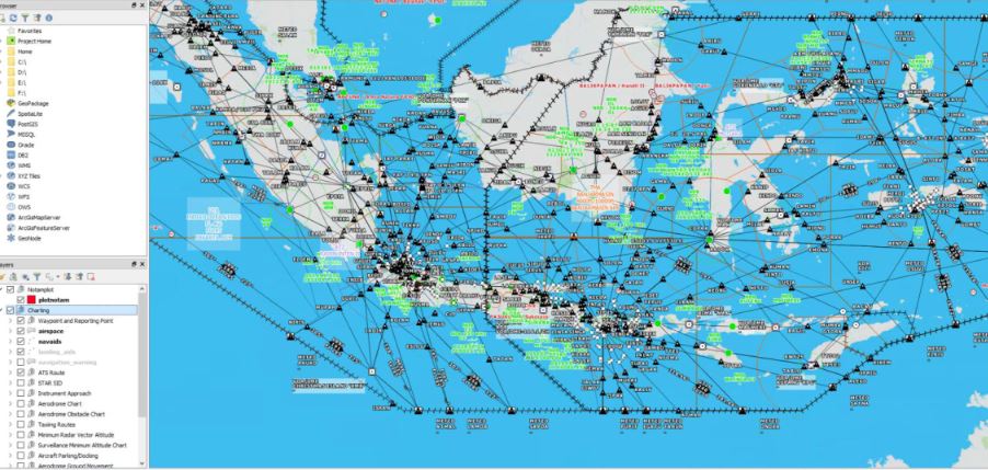
ELSA Charting tools For aviation ELSA charting tools for Aviation: Charting provides a true database-driven system to manage aeronautical data and rapidly produce charts that adhere to industry-and organization-specific requirements. Civil and military agencies, commercial airlines, and chart producers can create, maintain, and use standard aeronautical products based on the latest digital data.
• Produce all ICAO formatted charts according to ICAO annex 4.
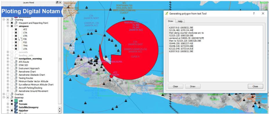
• Support to graphic digital NOTAM display
• Creation or modification via point and click chart Airspace, Routes, Airways, STAR, SID, Terrain , Obstacle and Aerodromes.
• Text search for charting layer.
• Calculate the weighted center and radius of any polygon or circle and generate great circle and curvebetween points.
• Charting tool use svg or gml and any data type for gis format.
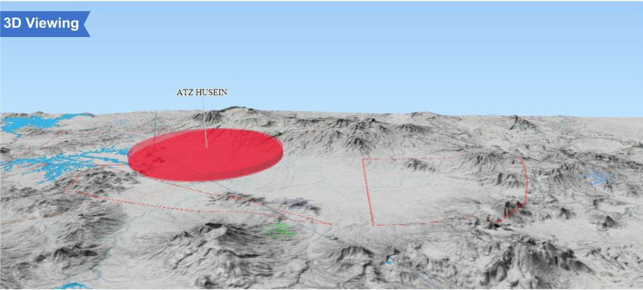
• Suport 3D viewing.
• Edit and update data once; the database-driven system updates all related chart products.
• The layout can be printed or exported to image formats, Postscript, PDF or to SVG.
• Overlays Layer include spot height, gridmoras, garticules & capital cities.
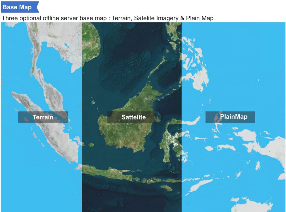
• 3 optional offline server base map : Terrain, Satelite Imagery & Plain Map
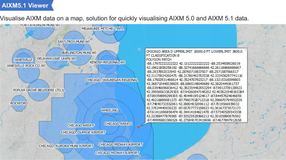
• Support AIXM 5.1 viewer.
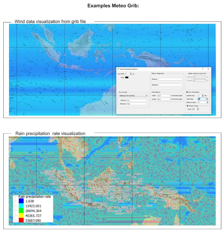
• Meteo GRIB.